Drone Management Software
Reduce risk and improve consistency
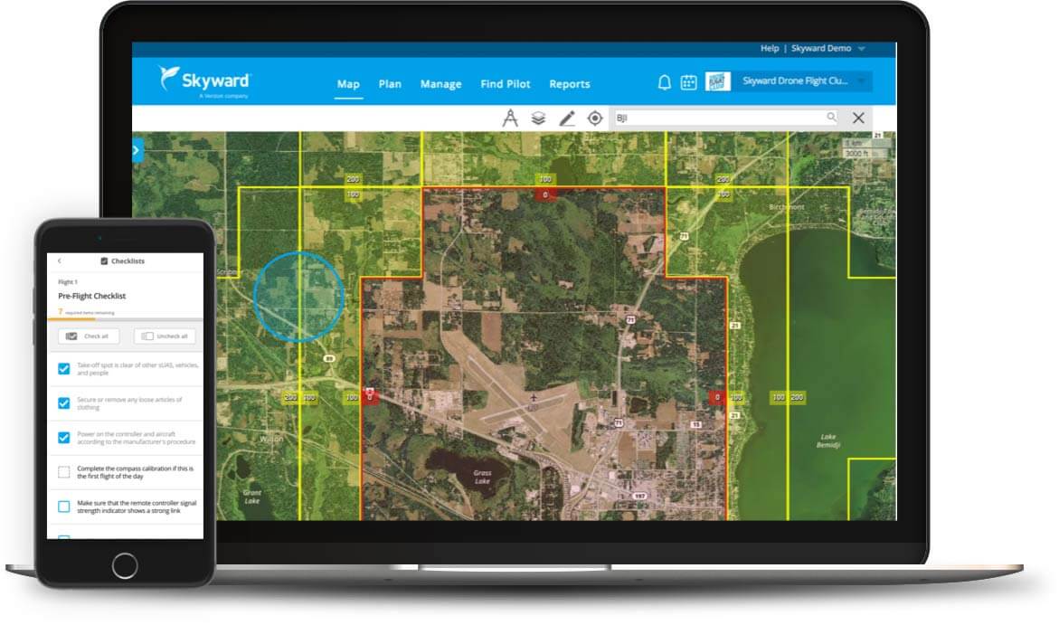
From job planning and execution to close-out and delivery, Skyward makes sure your entire team, both employees and outside contractors, follows the same standard processes every time, with customized checklists for different operations and environments.
- Distance and radial direction tools for improved precision
- Maintain consistent quality, high efficiency, and maximum safety
- Customizable checklists to finetune your workflows
- Set up best-practice checklists, training, and maintenance procedures
Comprehensive planning & record management
No matter how large your operation grows, Skyward drone software makes it easy to maintain comprehensive records on every aspect of your operation, including job specs, flight logs, pilot credentials, and equipment maintenance.
Make it easy for your executive, legal, and regulatory teams to access all the records they need – conveniently located in one place.
- Store flight logs, import flight data, and download reports
- Maintain consistent records for internal and regulatory audits
- Easily access crew member’s flight experience, documentation and credentials
- Track aircraft location and ensure proper maintenance